Description:


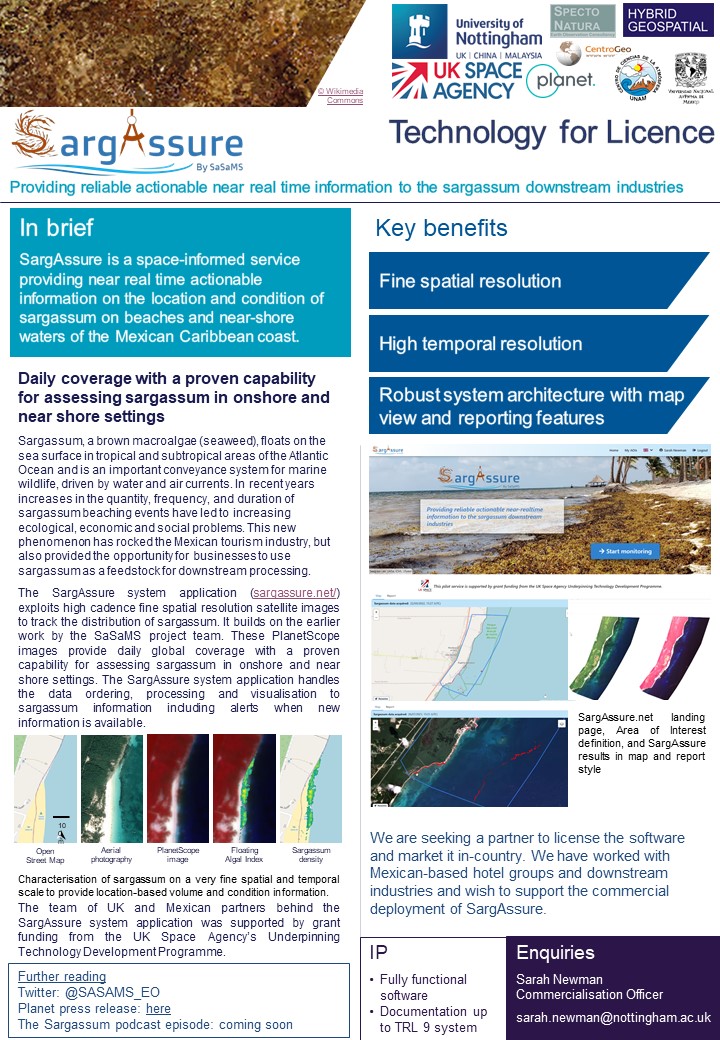
In brief
SargAssure (SargAssure.net) is a space-informed service providing near real time actionable information on the location and condition of sargassum on beaches and near-shore waters of the Mexican Caribbean coast.
Key benefits:
Fine spatial resolution
High temporal resolution
Robust system architecture
Demonstrations of the system available upon request
Please note that only users with pre-approved email addresses are authorised to create an account on SargAssure.net currently.
SargAssure Service
At the current stage of development, SargAssure consists of:
The user has access to a highly visual, tailored, and interactive service which offers a set of tools to present actionable sargassum-related information. It consists of a sargassum satellite surveillance service, deployed via a web application, with user access to a tailored analytics dashboard, providing sargassum alerts and quantitative actionable information. The service is completed with a user training and support programme to provide both capacity building in the target user community and contribute to building SargAssure’s future sustainability.
Maps are available with a spatial resolution of 3 m and cover the land area of the Gulf of Mexico plus a 15 km buffer offshore. The products offered by SargAssure are data-driven and include maps, explanatory contextual intelligence, and alerts informing decision-makers who are not necessarily experts in remote sensors / EO or data analysis (e.g., sargassum collectors, processing managers).
SargAssure ingests PlanetScope data, pre-processes it to remove artefacts such as clouds and shadows and then calculates a set of indices related to the presence of sargassum (e.g., the established Floating Algal Index (FAI)) and the condition as it dries out on beaches. The PlanetScope data has additional spectral bands which are well suited to map the location of macroalgal mats and the subtle changes in colour as it changes condition. Processing chains automate all the required functionality such as scheduling, orchestration and the execution of algorithms, saving results, and notifying users of changes.
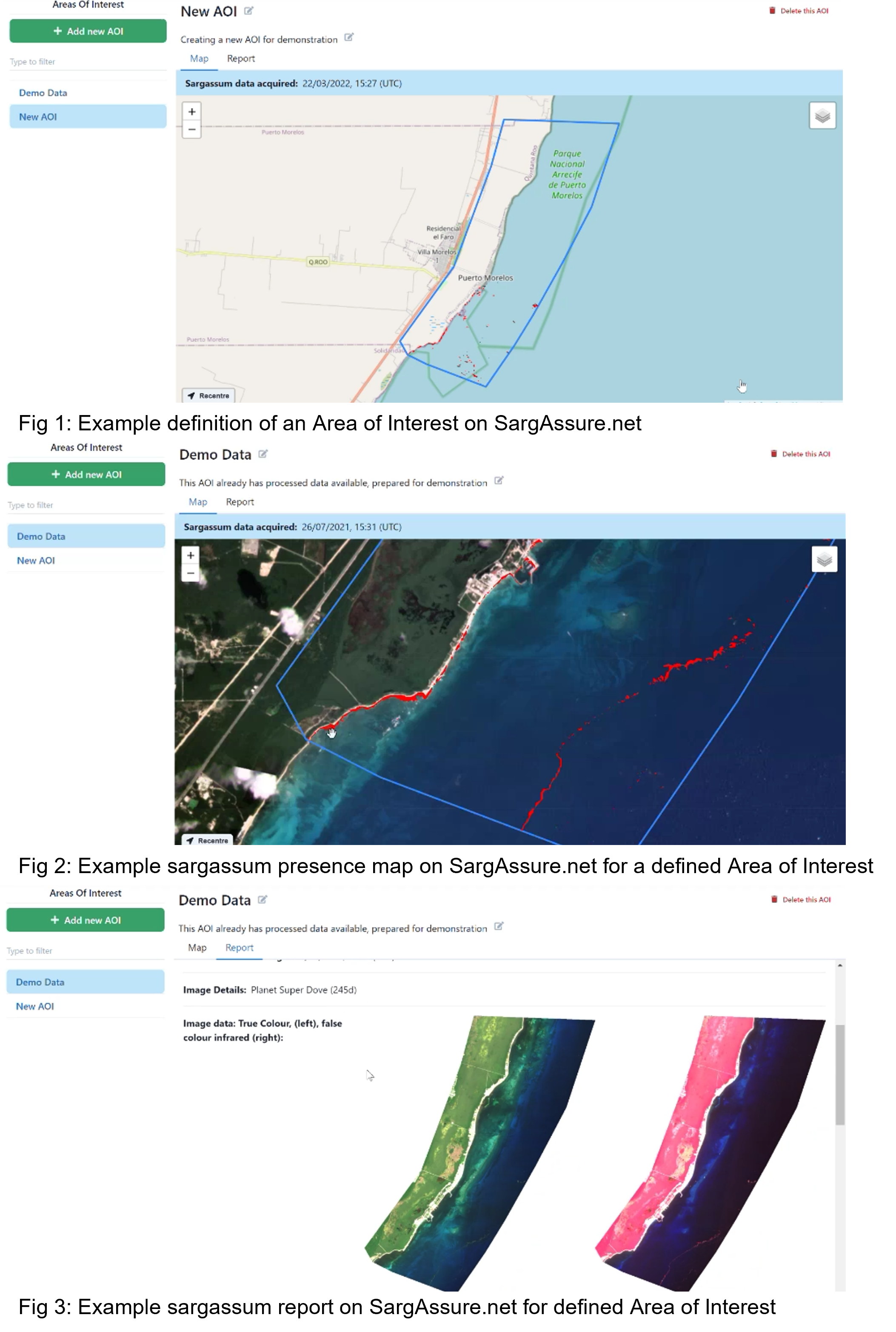
SargAssure is currently operational, albeit on a closed and limited basis. Figures 3.3–3.6 show the steps of using SargAssure.net, listed below.
-
The user defines an AOI (Figure 1).
-
Once defined, this immediately queues a request with Planet for satellite data. This process typically takes an hour. Once an area has been defined, each AOI is updated daily, and the user receives updates.
-
Results are displayed on the map (Figure 2) and in a report format (Figure 3).
Enquiries:
Sarah Newman - Commercialisation Officer
sarah.newman@nottingham.ac.uk
Download pdf